Bridging Columbia: Inside the Main Street–Vista Connector Project and What It Means for Downtown
- Javar Juarez

- Apr 23
- 4 min read

By Javar Juarez | CUBNSC
Columbia’s downtown core stands at a critical crossroads. As development accelerates between the historic Main Street district and the rapidly expanding Vista, city planners are moving forward with a project they believe will redefine how residents, workers, and visitors move through the capital city.
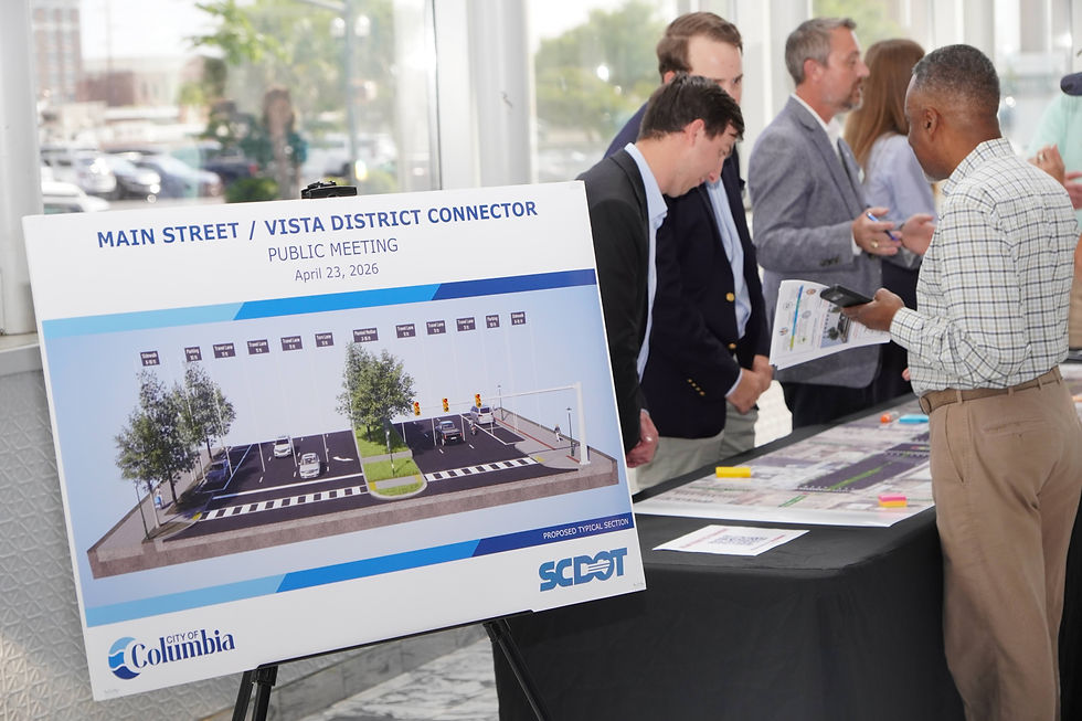
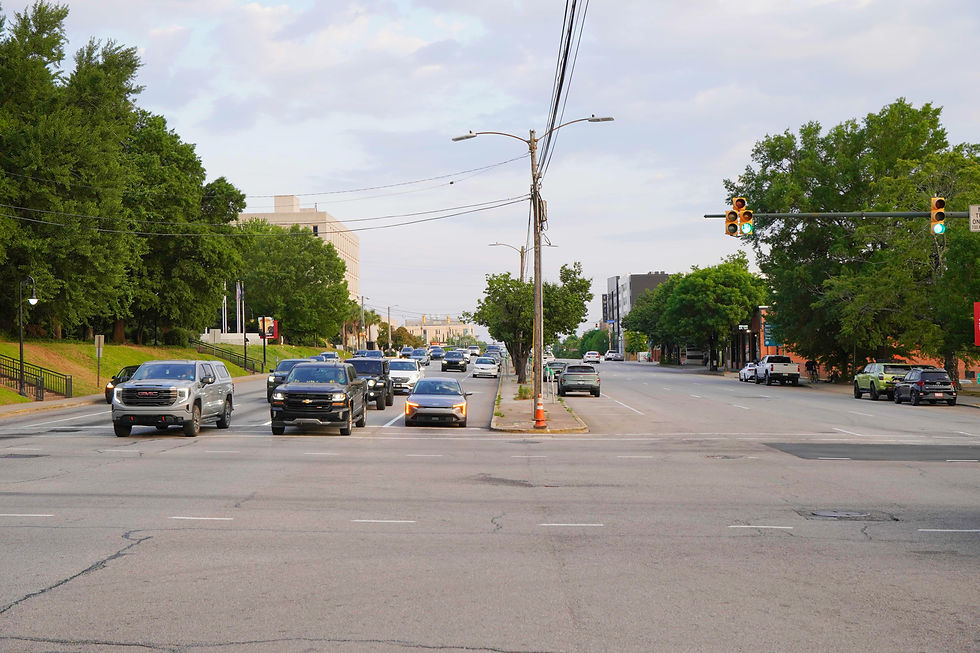
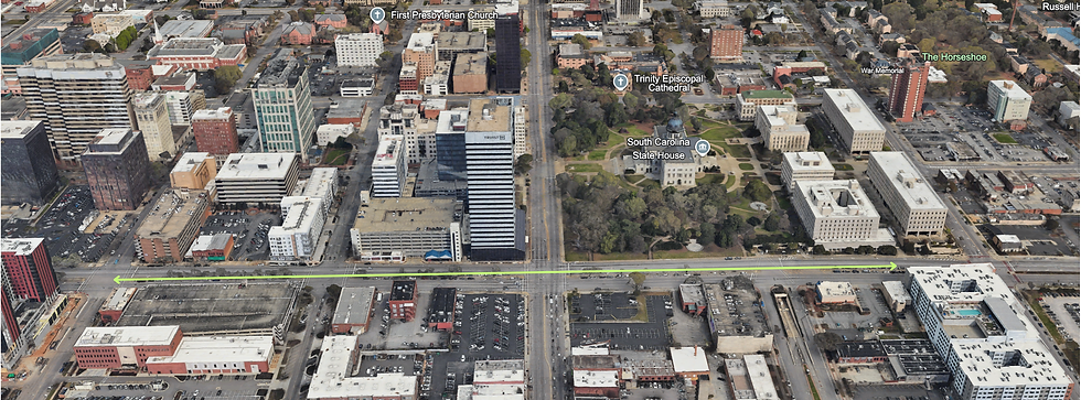
The Main Street/Vista District Connector Project, led by the City of Columbia in partnership with the South Carolina Department of Transportation (SCDOT), aims to transform Assembly Street from Pendleton Street to Lady Street into a safer, more accessible corridor for pedestrians while maintaining traffic flow for tens of thousands of daily drivers.
At its core, the initiative is not about slowing Columbia down. It is about making it safer to move forward.
A Corridor Under Pressure
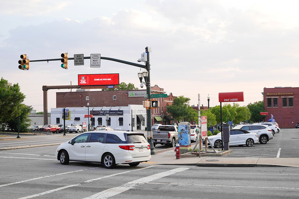
Assembly Street is one of Columbia’s most heavily traveled arteries, carrying an estimated 23,000 to 24,000 vehicles daily.
But behind those numbers lies a growing safety concern.
City planners and engineers have identified a pattern of mid-block crossings, near misses, and vehicle collisions, many tied to a long-standing design feature: median parking.
That parking configuration has encouraged pedestrians to cross multiple lanes of traffic outside of designated intersections. In real-world terms, that means individuals
navigating up to eight lanes of traffic, often without adequate protection or timing.
For elderly residents, people with disabilities, or anyone caught halfway across, the risk is not theoretical. It is immediate.
What’s Changing—and Why
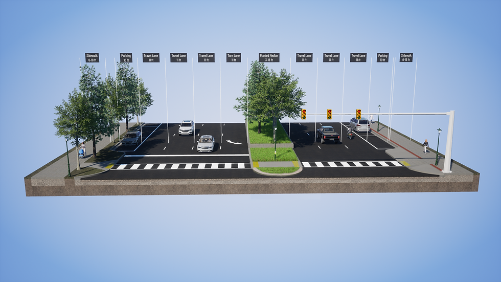
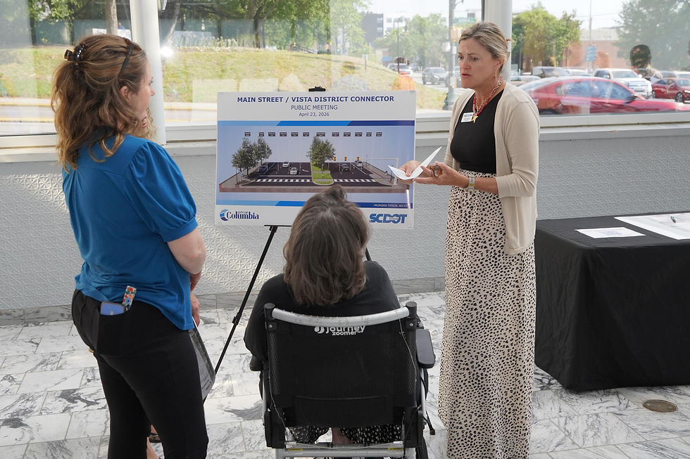
The proposed redesign introduces a series of structural changes intended to reduce that risk while preserving the corridor’s capacity.
Key Improvements Include:
Removal of median parking, replaced by a wide landscaped median
Pedestrian refuge islands to provide safe stopping points mid-crossing
Curb bump-outs at intersections, reducing crossing distance by up to 40–50%
Wider sidewalks, expanding from as narrow as 5 feet to potentially 14 feet
Reduced lane widths, without eliminating travel lanes
Enhanced pedestrian lighting, particularly in darker sections of the corridor
Traffic calming and beautification elements
These changes are designed to address both pedestrian safety and vehicle collisions, which are often linked to sudden stops caused by crossing pedestrians.
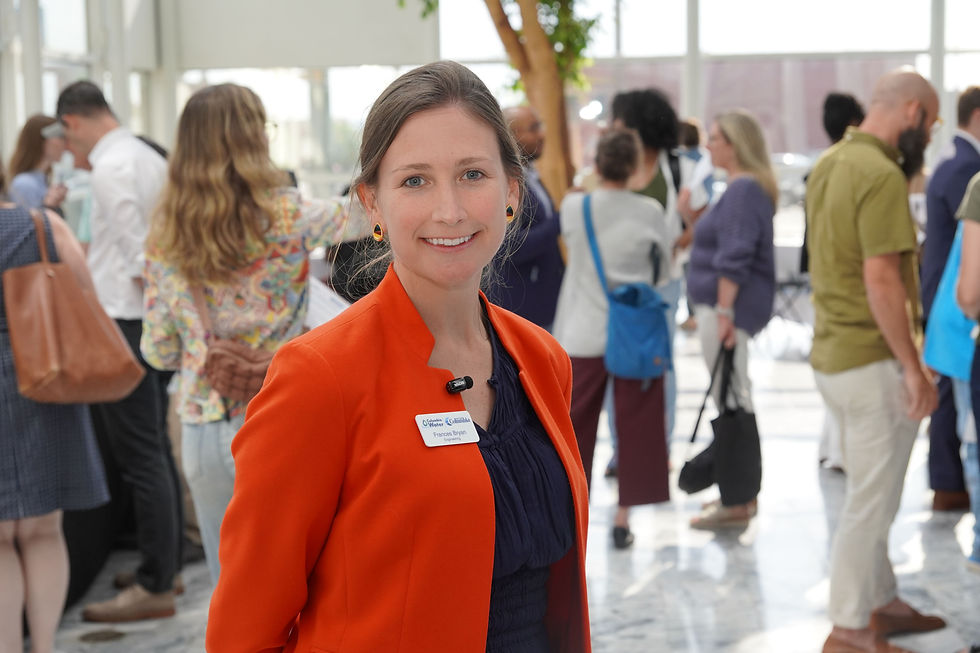
As City of Columbia representative Frances Bryan explained:
“We are really seeking to make it much, much more easy for pedestrians to access our Main Street district, our Vista district, and to get between the two safely and efficiently.”
A Balancing Act: Safety vs. Access
The project does not come without trade-offs.
Median parking will be removed, a concern for some drivers and business owners. However, planners note that some parking will be reintroduced along the sides of the street, and no primary travel lanes will be eliminated.
Instead, the project represents what one official described as a “compromise”—a recalibration of space that prioritizes safety without sacrificing mobility.
Notably, the city has chosen to redirect bike and scooter traffic to side streets, keeping Assembly Street focused on high-volume vehicle movement.
Economic Implications: More Than Infrastructure
While the project is framed around safety, its long-term implications are economic.
Assembly Street sits at the intersection of:
The State House
The Main Street business district
The Vista entertainment corridor
With continued residential and commercial growth in the area, city officials believe improved walkability could unlock new economic potential.
“If you create an environment that fosters growth and interconnectivity… this is just going to create a whole new ambiance between those two areas,” said one longtime Elmwood resident.
In other words, safer streets could mean stronger foot traffic, longer visits, and increased spending across downtown Columbia.
Lighting, Accessibility, and Modern Design
Beyond traffic flow, the project also addresses quality-of-life issues.
Plans include:
Brighter, more consistent lighting across the corridor
ADA-compliant features, including tactile warning surfaces for visually impaired pedestrians
Expanded pedestrian signal timing, giving individuals more time to cross safely
There is also growing public interest in incorporating environmentally friendly lighting solutions, such as solar-assisted LED systems—an idea city officials indicated could be considered as public input is gathered.
Timeline: A Multi-Year Effort
The project is still in its early phases, with a multi-year rollout:
Fall 2025: Environmental studies and stakeholder engagement
Spring 2026: Public meetings and design coordination
Summer 2026: Final roadway plans and right-of-way approvals
Fall 2026: Final construction and landscape planning
Spring 2027: Construction bidding and project launch
The schedule remains subject to change, depending on funding, approvals, and community feedback.
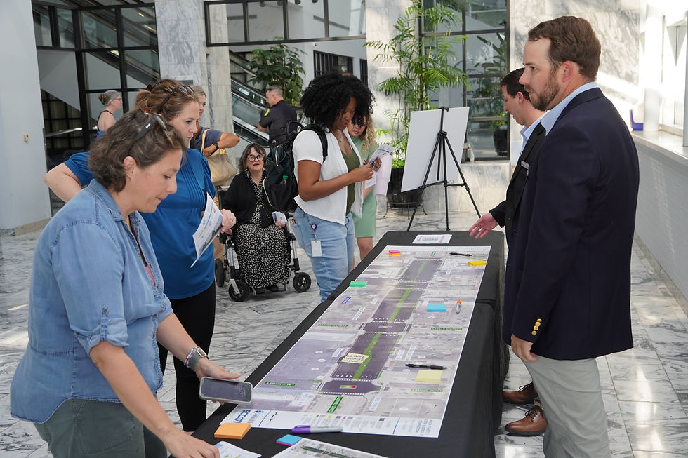
Public Input: Your Voice Matters
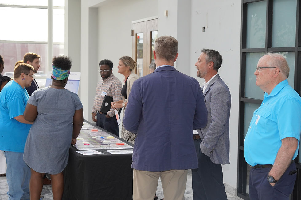
The City of Columbia is actively encouraging residents, business owners, and stakeholders to weigh in.
Public comments will be accepted through May 15, 2026, via the project website.
Residents can also contact the project representative directly:
Frances Bryan | Frances.Bryan@columbiasc.gov | (803) 545-3544


Comments